Gaustatoppen is arguably one of the most beautiful mountain peaks in Norway. Rising far above any surrounding peaks, it offers one of the most amazing views on a clear day.
This has made it one of the most popular mountain hikes in Norway, attracting tens of thousands of visitors each year. Located just a 2-and-a-half-hour drive west from Oslo, the trip could be made in a day. Alternatively, you can stay the night in the beautiful mountainous terrain and explore the old industrial town of Rjukan and its exciting history and attractions.
In this article, we provide you with an all-inclusive guide for planning your hike to Gaustatoppen.
About
Gaustatoppn is southern Norway’s highest peak at 1883 meters above sea level. At the top, you are offered Norway’s greatest view as you can see ⅙ of Norway’s land area on a clear day. To put that in perspective, that is more than the entire land area of Denmark.
The reason for this is that Gaustatoppen is made of a harder type of rock than any surrounding mountain. Therefore, surrounding peaks have been worn down by the elements at a higher rate than Gaustatoppen, enabling it to tower above all peaks in southern Norway.
Getting there
While it is possible to take the bus from Oslo to Gaustatoppen, having a car makes the trip a lot easier.
Car
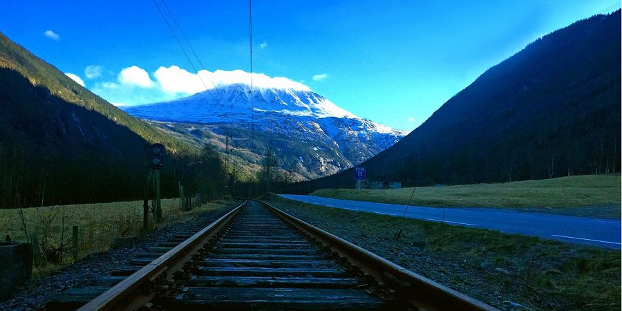
Gastatoppen is located close to the former industrial town of Rjukan. It is about a 2-and-a-half-hour drive from the greater Oslo area. The fastest way is to follow Highway E134 through Kongsberg and Notodden, after which you follow signs to Rjukan once passing Notodden.
While there are other trails to the top, the most common and recommended route is from Stavsro where there is a dedicated parking lot. It costs 150 NOK for 1 day, but make sure to arrive early during peak season (June to September) to secure a spot as they fill up quickly.
Bus
Vy has express buses between Oslo and Notodden, from which you can take the local bus between Notodden and Rjukan. The trip is available 5 times per day for 475 NOK and takes about 3 and a half hours.
From Rjukan you can catch the mountain bus which takes you to Stavsro. From mid to late June June until mid-August the bus is scheduled daily, after which it runs on the weekends until mid-October. You can find the timetable here.
Because the bus ride to and from Rjukan takes over 6 hours total, it is best to plan to stay at least 1 night before higher the day after. Fortunately, Rjukan has many attractions and adventures for you to explore during the tourist season. Make sure to head over to visitrjukan.com, the website of the local tourist association to help plan your trip.
What to bring
While not the most challenging hike, it is best to be prepared and have the right equipment for your trip. Unfortunately, many tourists attempting popular hikes in Norway come very unprepared, especially when it comes to their shoes.
The most important is to bring a good pair of shoes. I recommend you bring a solid pair of hiking shoes. A solid ankle boot is also a good choice, as the trail is quite rocky, for which ankle support can come in handy.
While you can easily make the hike with some decent trainers in the summer, don’t count on it, make sure to have a backup.
When it comes to the rest of your clothing, it depends on the season. During summer the temperature can be comfortable enabling you to hike in shorts and a t-shirt, however, autumn can be cold. also, it can be quite windy towards the top.
As a general rule, don’t count on shorts and a t.shirt even though the weather will be nice, make sure to bring a thicker tracksuit and/or wind jacket. In autumn you should have some solid hiking pants and a warm jacket as well as a hat/cap.
Finally, make sure to bring water and some food to eat once you get to the top. Should you need an extra snack, the Norwegian tourist association has a kiosk at the top that sells soda, waffles, and hot dogs during the summer season.
The trail
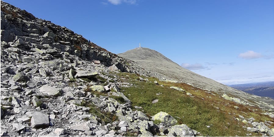
While there are several trails to the top, the most common and recommended is the trail from the Stvsroa. The hike is about 8.7 kilometers long, takes a total of 4-6 hours, and takes you up and down a total of 660 meters from start to finish.
With the right shoes and clothes, anyone with a standard fitness level should make the hike without difficulties. That being said, on a scale from easy to hard, the difficulty level should be considered Medium.
In the beginning, the trail is, wide, and flat, and slopes gently up toward the mountain. As you climb, the trail gradually narrows and the terrain becomes quite rocky. The final stretch to the top is quite steep and you will find yourself stepping on a huge pile of rocks,
This can be quite challenging if you are unlucky and encounter bad weather on your hike as the rocks can get quite slippery. This emphasizes yet again having the right clothing and equipment for the hike.
Hopefully, the weather gods will rule in your favor, after which you can enjoy the amazing 360-degree view from the top.
Where to stay
If you take the bus or plan to stay for longer than the hike alone, you need a place to stay. While there are other options, the most common is to either stay at the nearby mountain and ski resort of Gastablikk or in the town of Rjukan just down in the valley below.
The ski resort of Gaustablikk høyfjhellshotel is a hotel a short drive from the foot of the mountain and welcomes people the whole year round. Likewise, the historic Hotel Rjukan Admiini hotel accommodates people in Rjukan.
For cheaper accommodation, you can check out the hostels Kvitåvatn Fjellstue and Rjukan Gjestegård. For more information and other options, click this link to check out the accommodation page on www.visitrjukan.com, the website of the local tourist association.